Geographical API services – NFleet Routes API
Get a distance matrix and a route path
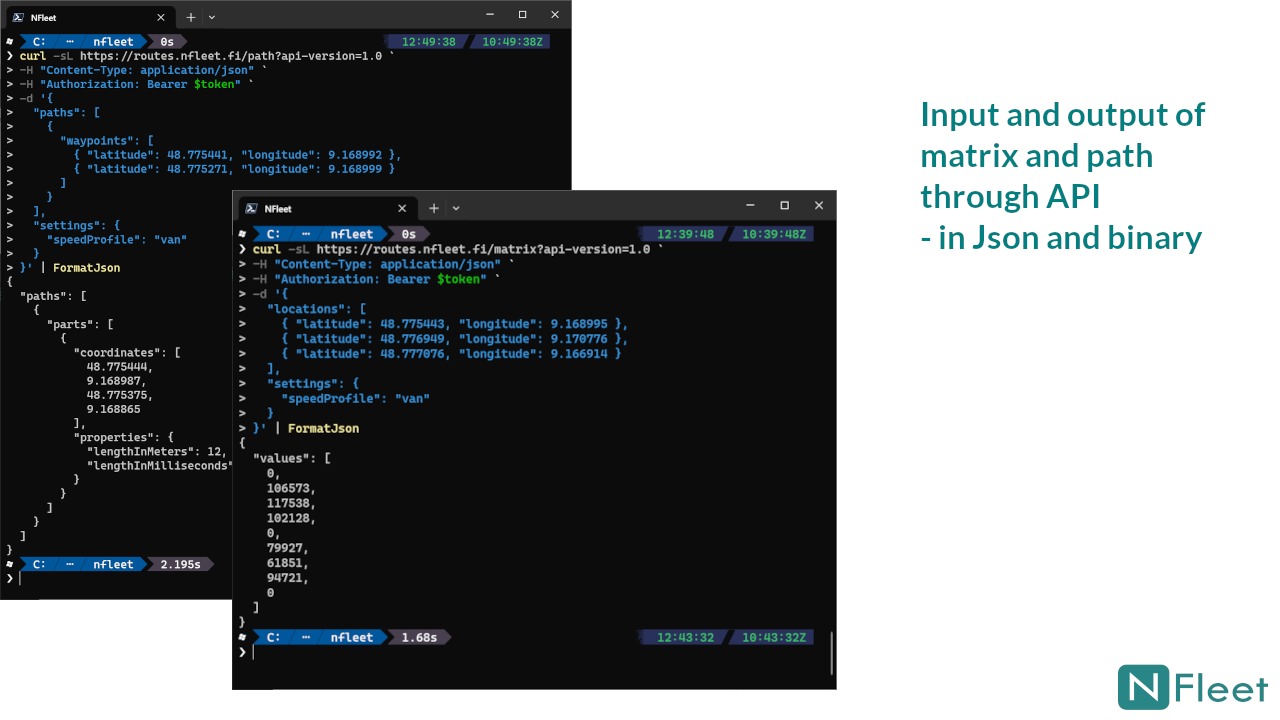
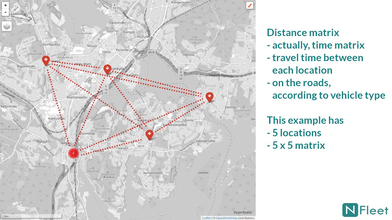
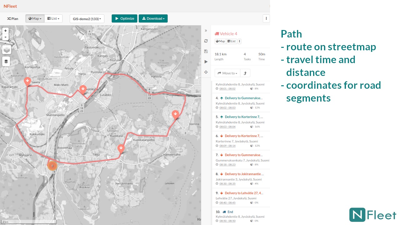
For a distance matrix you input all locations in coordinates and in return you will get the full matrix with travelling times between all locations. For a route path you input the path locations in coordinates and in return you will get the travelling times, distances and detailed coordinates for illustrating the path on a map.
Details:
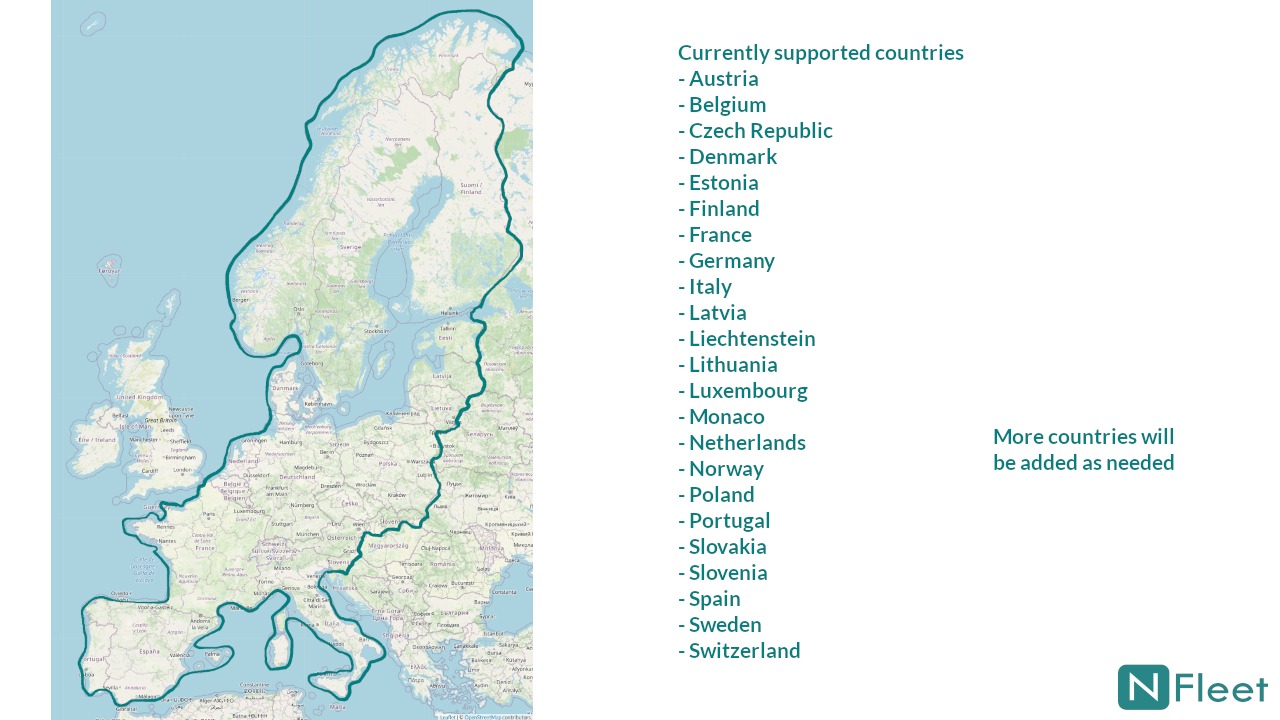
- Geographical coverage: OpenStreetMap map data in Northern and Western Europe, more countries per request (see the slide for details)
- Vehicle profiles: pedestrian – bicycle – tractor – car – van – truck
- Data format: JSON and binary
- Max matrix size: 5000 locations (5000 x 5000 matrix)
- Matrix calculation time: max few seconds
- Max path size: 500 locations
- Path computing time: max few seconds
Typical application for the services is route planning. Distance (time) matrix is the starting point for optimizing route planning and the resulting route details are provided by the path service.
Availability
The NFleet Routes API services are available in Microsoft Azure Marketplace. Plans to purchase are available for different sizes of use, including a pay-per-use plan for occasional needs and free trials. Please contact us at info@nfleet.fi if you have questions or requests.
NFleet distance matrix calculation was originally designed for our own internal transportation planning optimization needs and has been in operational use 24/7 since 2014 and with a major upgrade in 2018. However, we have noticed that commercially available services are quite few and with relatively limited capacities and high price. We therefore wanted to make our geographical services publicly available.