NFleet API Interface
The different components of the NFleet system are linked together via API interfaces. When necessary, they enable the technical integration of system components or the entire system into larger entities.
Background
Through the API interfaces, transportation planning source data can be imported into the NFleet system and planning results can be returned, allowing the system to be operated remotely outside of its own user interface. Additionally, the geographic service is a central part of the system, and its various components can be used separately through the interface if needed.
We have implemented the map service primarily ourselves, partly relying on open-source libraries. We previously considered map services offered by third parties, but they proved to be limited in functionality or capacity and expensive to use. Therefore, we wanted to release these services for general use as well.
API Interfaces and Testing
All system interfaces are available for use. The central and comprehensively documented interfaces are:
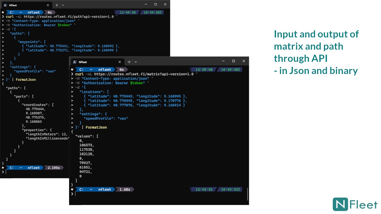
- Routes API: distance matrix and shortest path information
- Address API: geocoding and reverse geocoding
- Planner API: using the planner via an interface
- (Coming soon Converter API: using the converter via an interface)
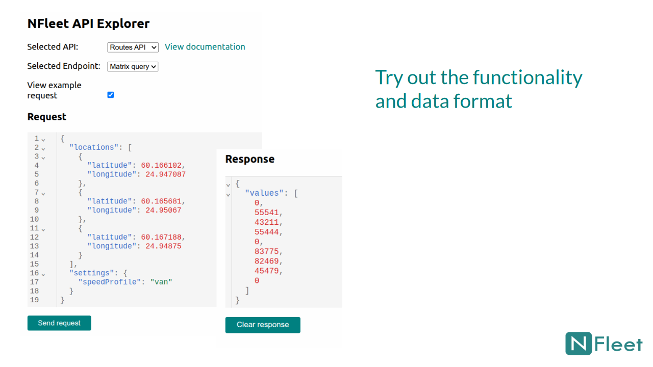
The free NFleet quick trial and test use also include the API Explorer function, which can be used to test the functionality and data model of the Routes API and Address API services. An API key is also available for a limited time during the trial.
Availability
Routes API and Address API are available on the Microsoft Marketplace. The Planner API is available by contacting us directly.
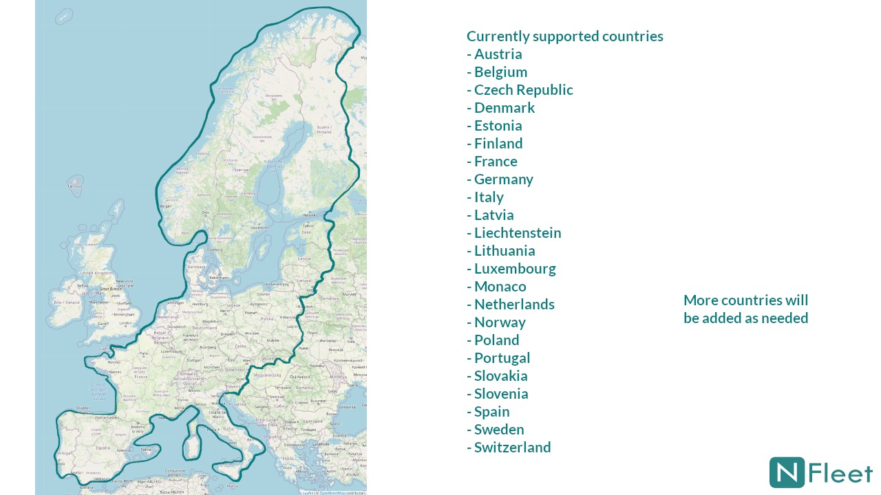
The system's current operating area covers most of Europe; the area can be expanded based on demand.